🌦️ Canary Islands 5M DEM Terrain | MSFS
Content: text (16 symbols)
Available: 1
Uploaded: 05.04.2025
Positive responses: 0
Negative responses: 0
Sold: 0
Refunds: 0
Seller: Aerosium
information about the seller and its items
Loyalty discount! If the total amount of your purchases from the seller more than:
| $5 | the discount is | 3% |
| $10 | the discount is | 5% |
| $20 | the discount is | 7% |
| $50 | the discount is | 10% |
| $200 | the discount is | 15% |
| $1000 | the discount is | 20% |
$10.9
🌦️ Canary Islands 5M DEM Terrain | MSFS
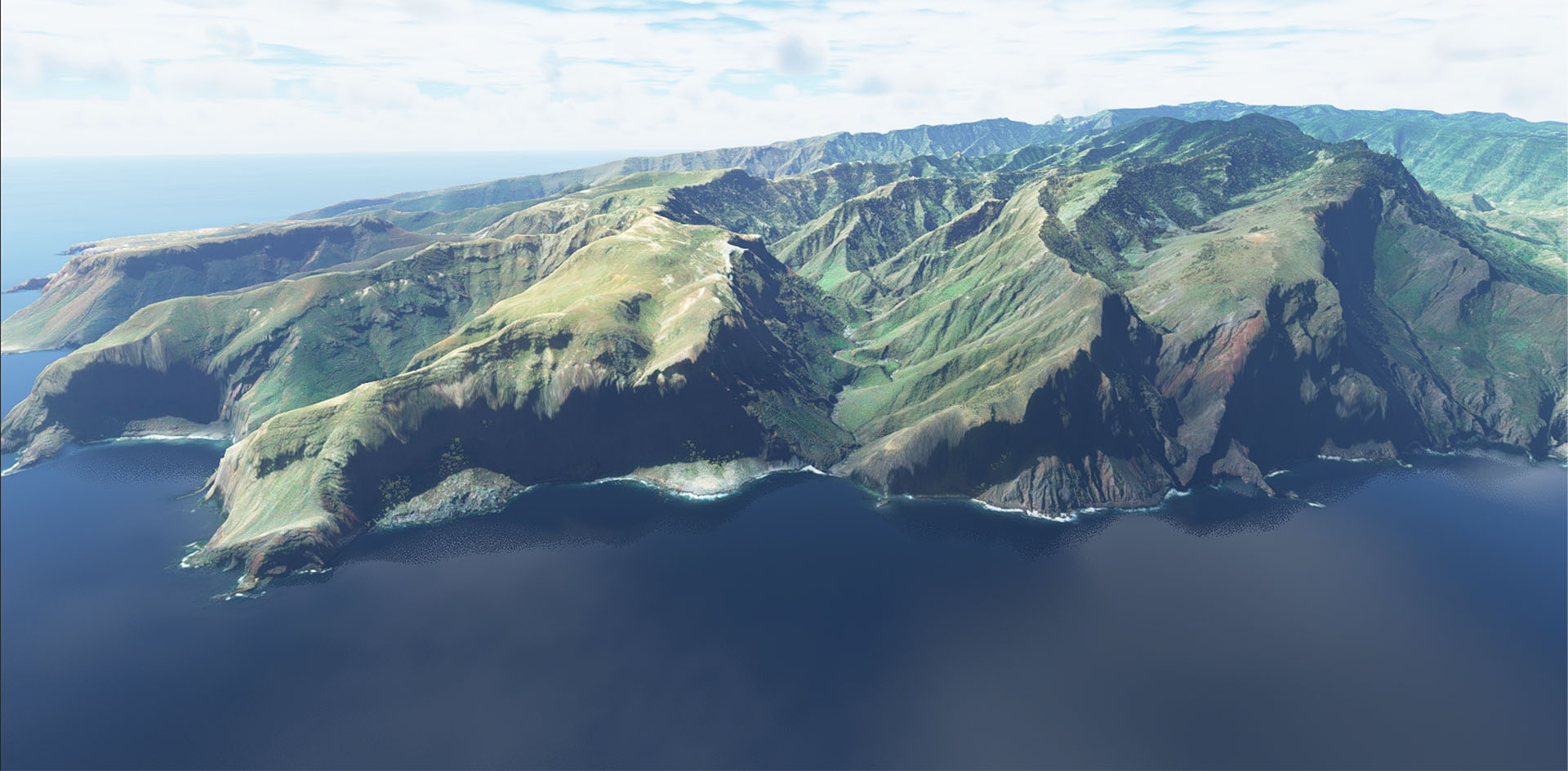
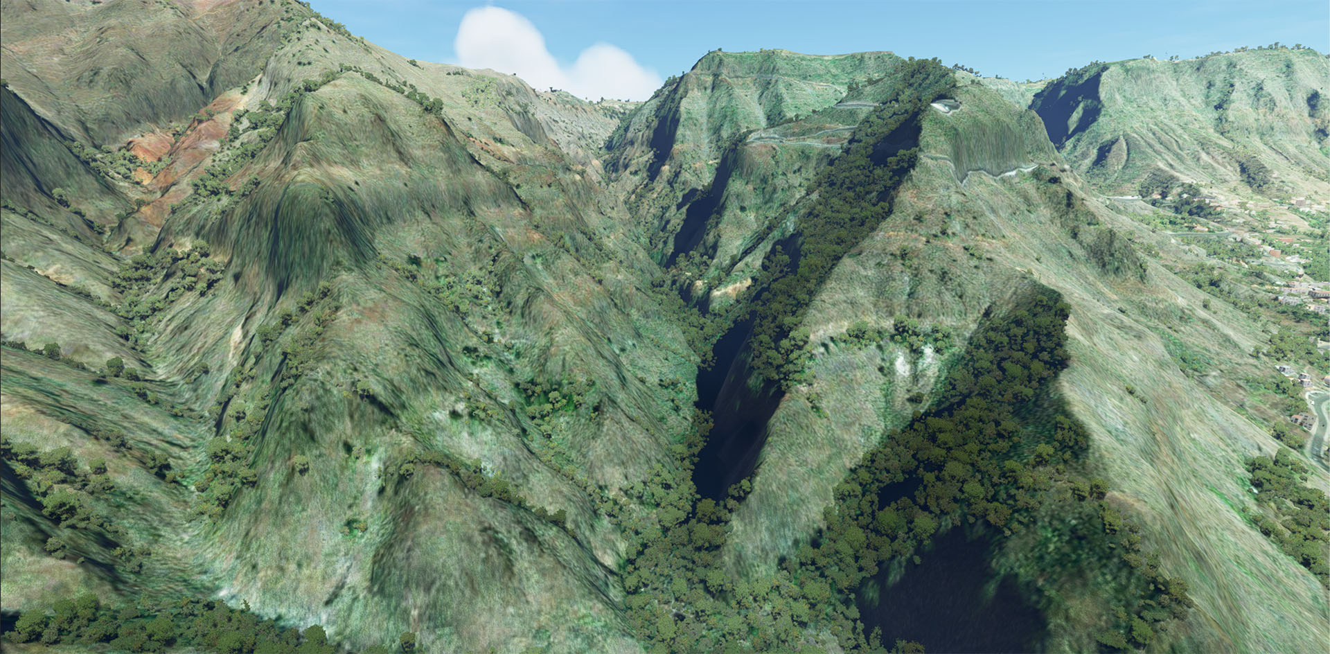
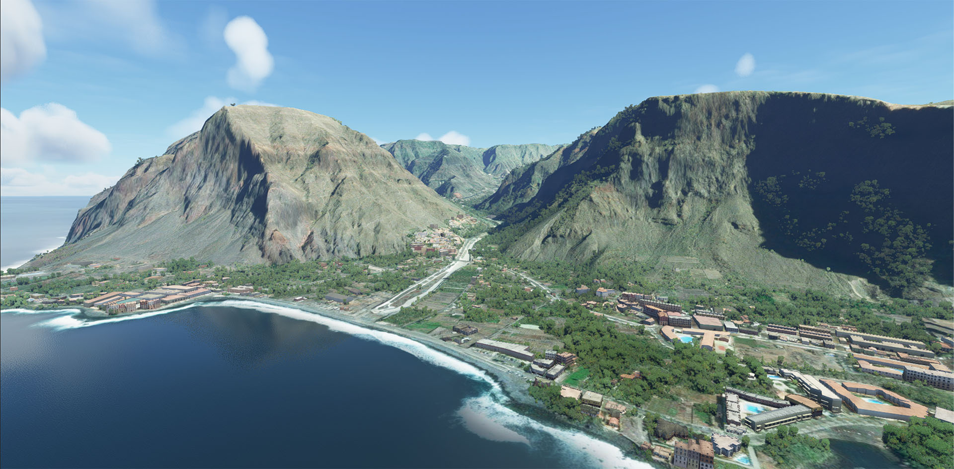
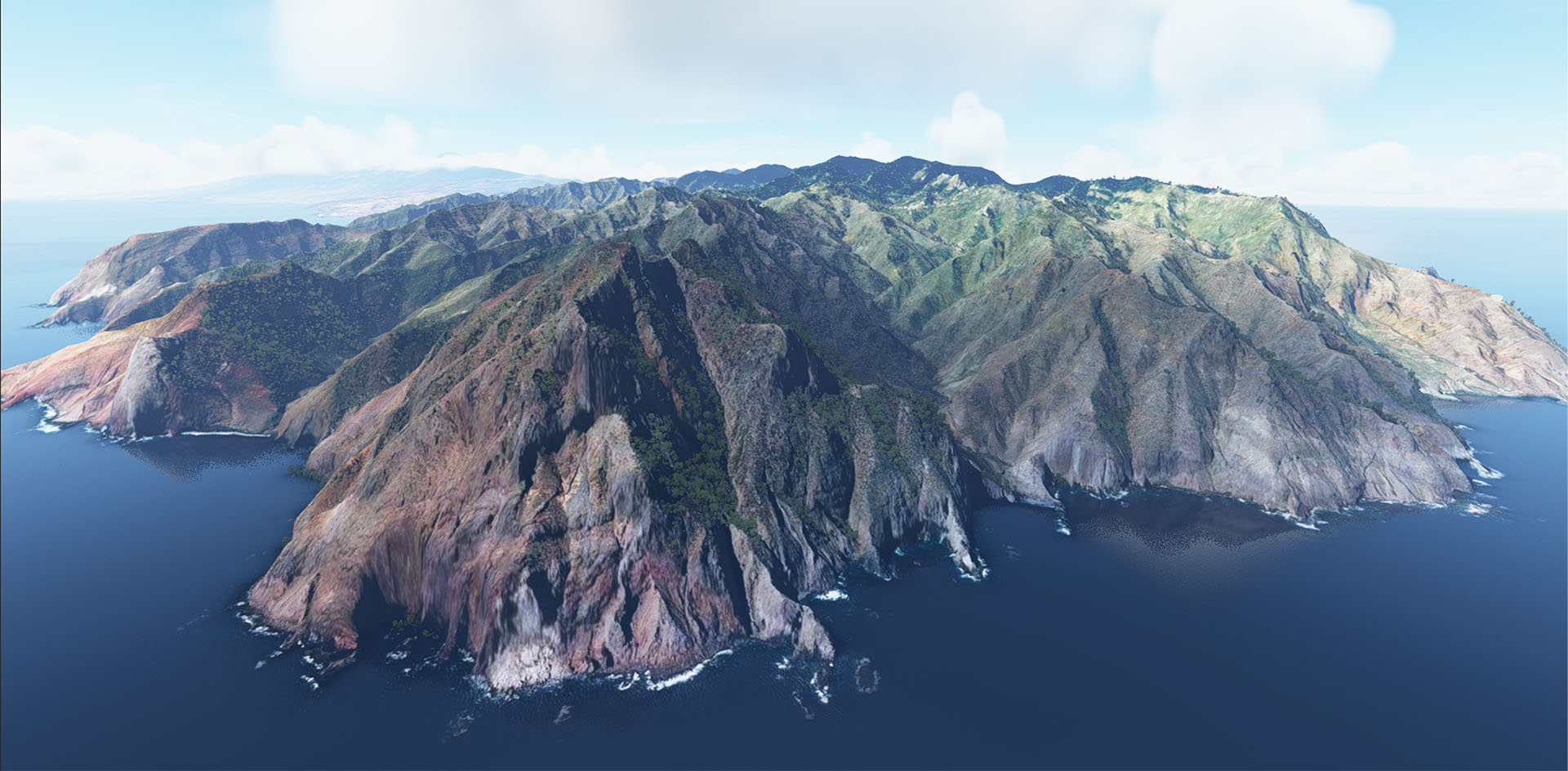
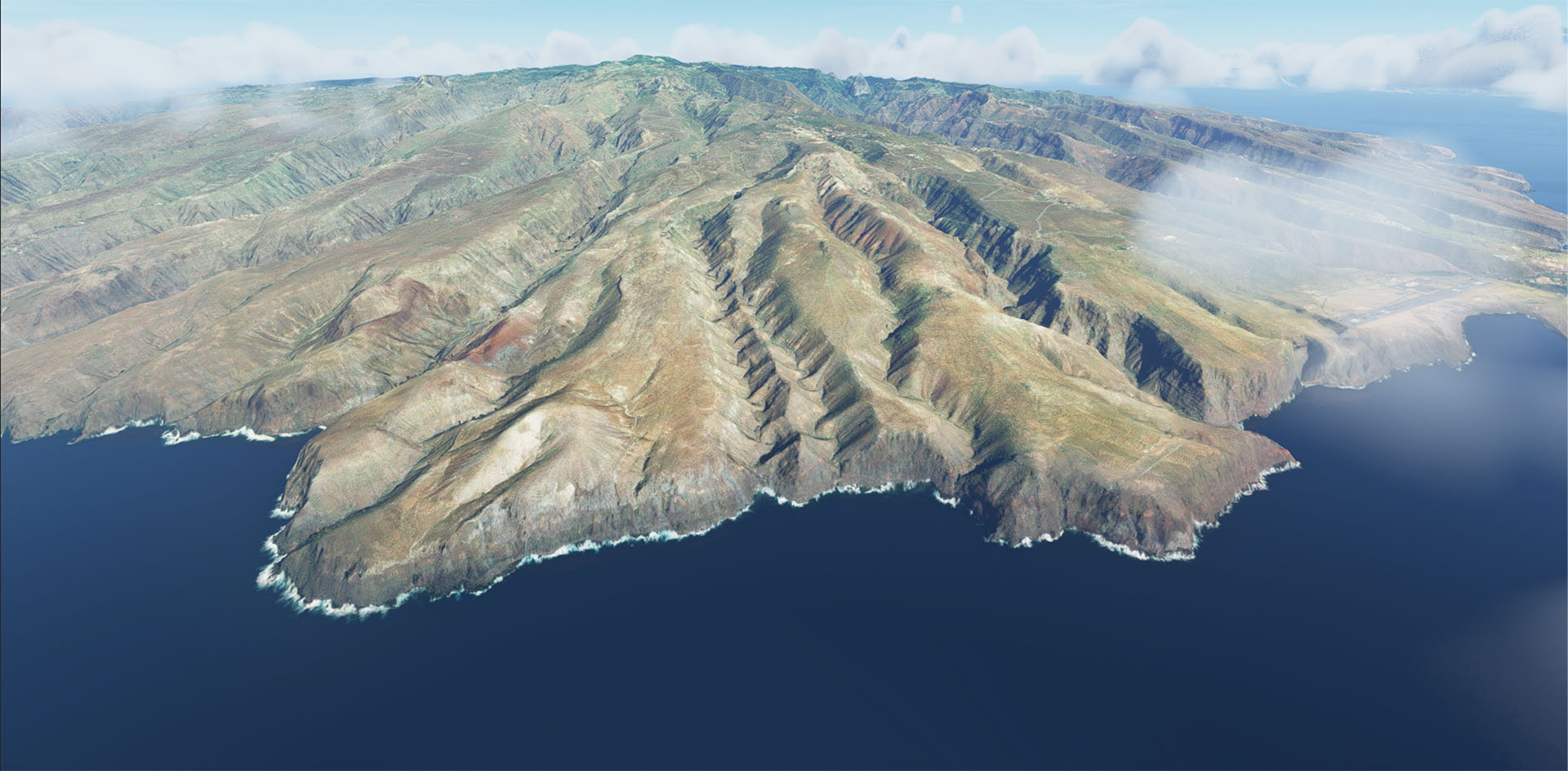
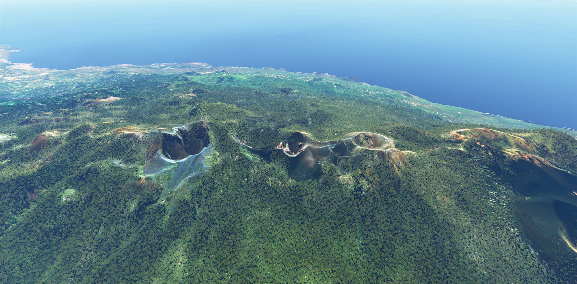
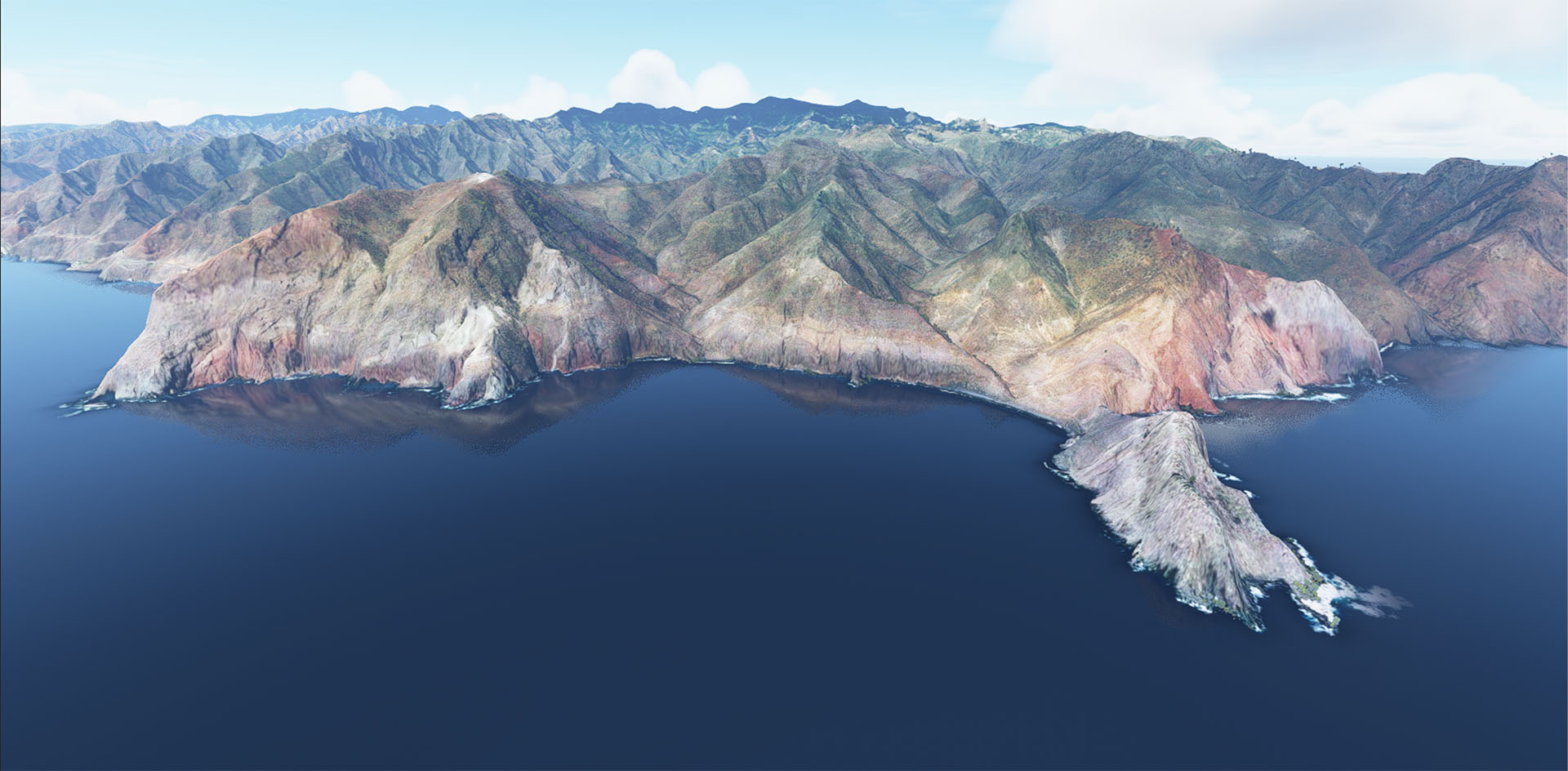
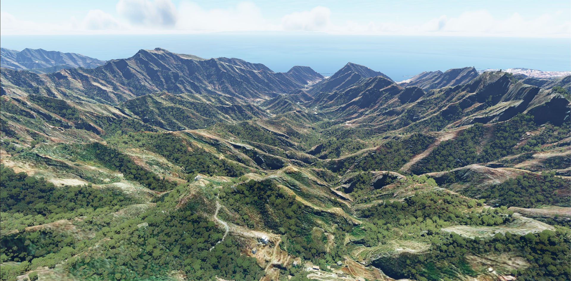
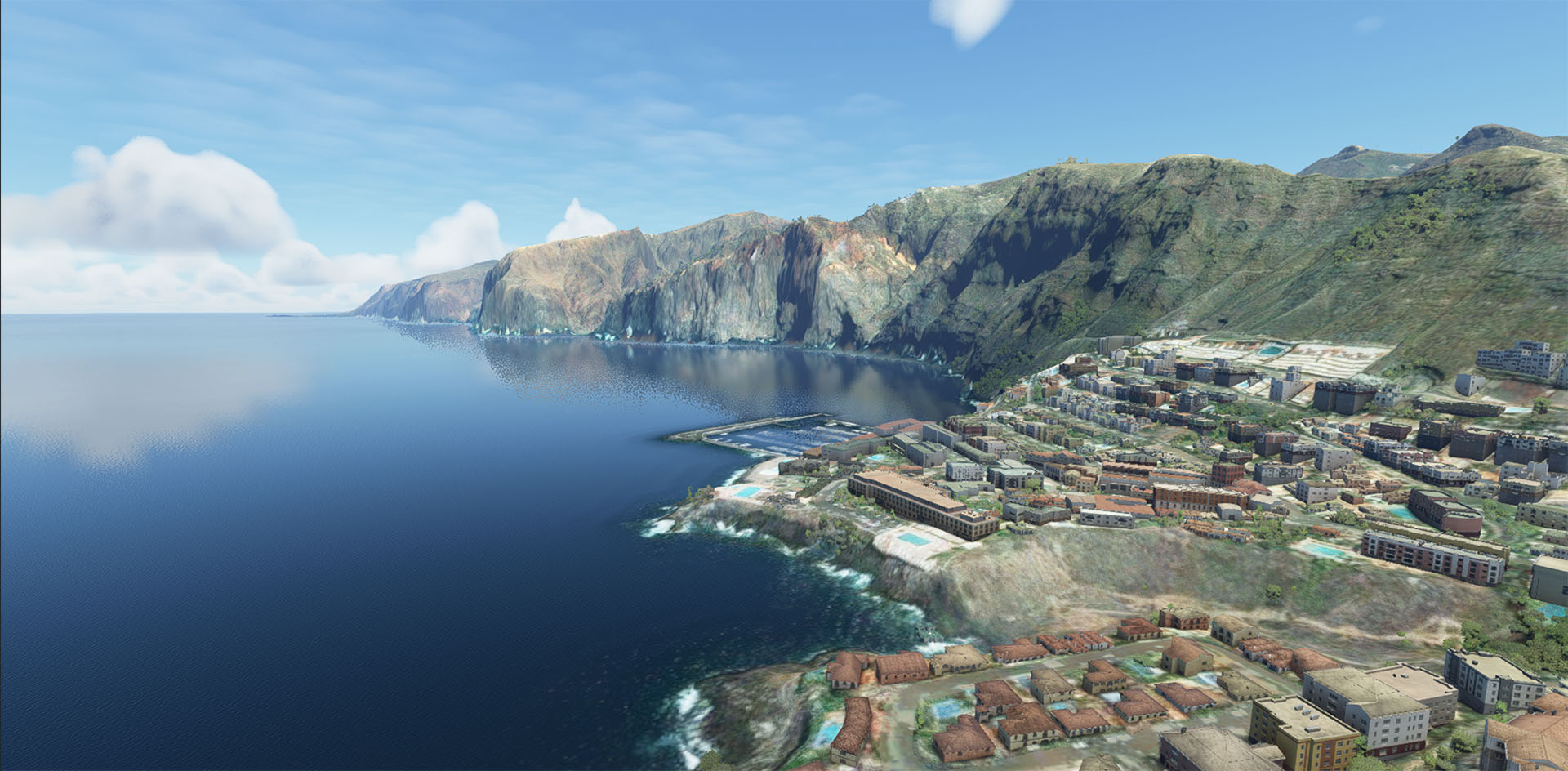
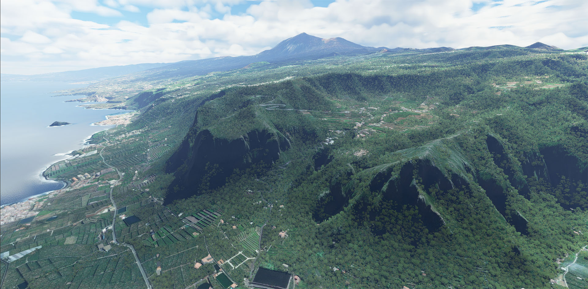
Experience the stunning landscapes of the Canary Islands with high-precision terrain data. This officially licensed product offers detailed 5-meter resolution terrain reproduction. The scenery perfectly integrates with all archipelago airports, creating a seamless flying experience.
What you get:
✅ High-precision Canary Islands terrain
✅ Official product access
✅ Permanent link to download product, license key and instructions
✅ Enhanced airport integration
✅ Access to updates
✅ Technical support
Key features:
• 5-meter DEM resolution based on LIDAR data
• Precise terrain correction around airports
• Enhanced Gran Canaria and Tenerife landscape
• Optimized performance
• Realistic transitions between different terrain types
Why choose this product:
• Highest resolution terrain available for Canary Islands
• Professional optimization for all major airports in the region
System requirements:
📌 Microsoft Flight Simulator 2020 (latest version)
⚠️ Important: This product is sold under the developer´s terms.
No feedback yet